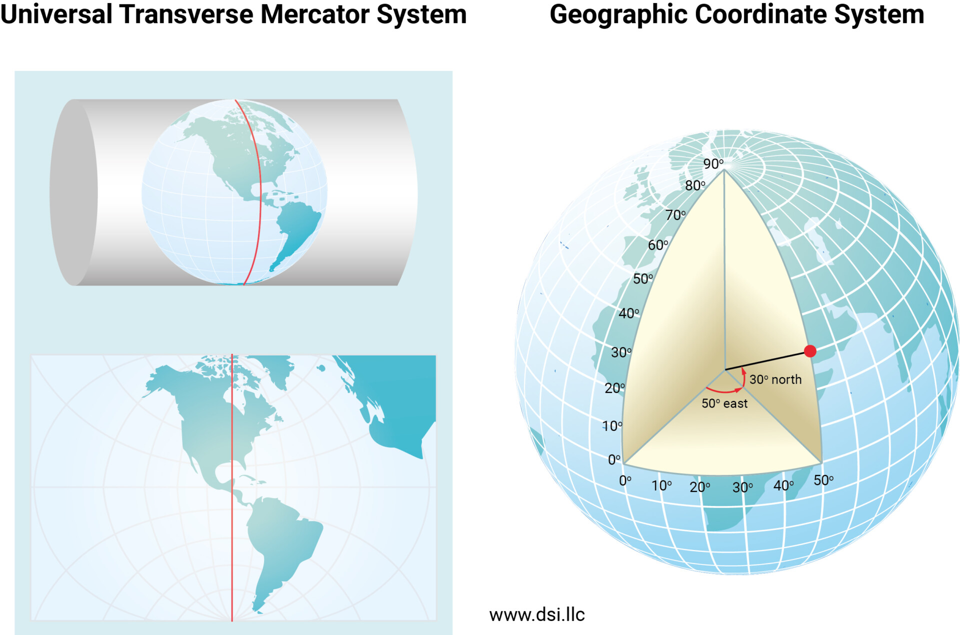
Spatial reference systems play a crucial role in data processing and visualization, as well as in interpreting the model output in EEMS. With the release of EEMS 12, the Geographic Coordinate System (GCS) is introduced. The GCS is a critical new feature, allowing users to handle geographic data more accurately and efficiently. The GCS in EEMS 12 aims at (1) resolving existing limitations of the currently available reference systems of the Cartesian coordinate system and Universal Transverse Mercator (UTM) system and (2) facilitating data processing where GCS acts as a fundamental projection system.

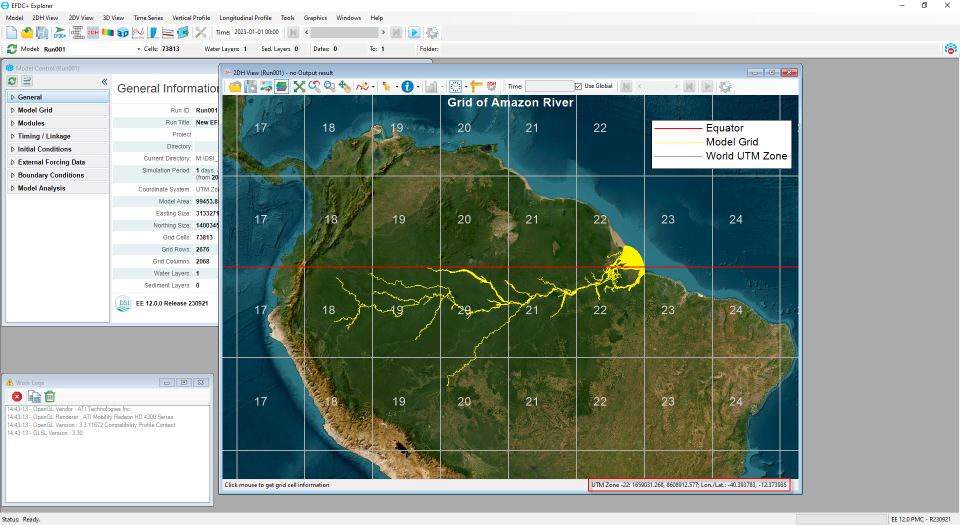
Prior to this release, EEMS only supported two coordinate systems: the Cartesian coordinate system and the UTM system. The Cartesian coordinate system primarily allows for simulations that require X and Y coordinates of calculation grids with a designated unit (meter), while the UTM system enables processing data overlain on a specified UTM Zone. However, both systems exhibit limitations when working with model grids spanning multiple UTM zones. UTM-projected data spreading over a large area (i.e., model grids, tropical cyclone tracks), especially those located far from the designated central meridian, are prone to spatial deformation, thus resulting in misinterpretation. These shortcomings can be handled using a GCS, an essential tool for data processing over multiple UTM zones. A comparison of the two systems is shown in Figure 1, while Figure 2 shows a sample grid of the Amazon River which covers 6 UTM zones but can be visualized accurately by GSC of EEMS12. The ability of the GCS to define two-dimensional coordinates – longitude and latitude – based on the Earth’s surface not only preserves the accuracy of visualizations of data points under a single projection but also avoids spatial distortion of the model and data.

Apart from the need to overcome the challenges described above, the development of the GCS was also motivated by the desire to align EEMS better with recently implemented features and the more up-to-date GIS-related analysis. The propwash module and NetCDF export function are two recent features that require data to be organized and presented in a longitude-latitude system. Moreover, there is an increasing need to visualize model outputs in GIS and WebGIS systems where GCS is often utilized as the primary projection. Enabling models to be defined in GCS thus significantly enhances the accessibility of EEMS output data.
Moreover, EEMS 12 can handle more than just the three reference systems of GCS, Cartesian coordinates, and UTM. This latest version of EEMS can convert between various projections. This capability means that users can import any projection by opening a project or loading a projection file, then convert it to UTM or GCS for displays and EFDC+ simulations. In cases where the projection of the loaded project is unspecified, the user can also define a system of choice for it in EEMS 12.
In subsequent blogs, we will explore various features and properties of the EEMS12 GCS and different ways to configure the Projection Settings in this new release version.


