Due to the developments made to how EEMS now handles the projection specifications of working projects, some projection settings in the new EEMS release should be attended to at the importation of an already built project or related project files such as the domain outline. These settings aim at adapting the working project to its correct CRS and ensure the computational accuracy of geographic data in later processing stages. In this blog, we will look at these settings and explore different options to modify the projection settings in EEMS12.0.
The Coordinate System specification window
Upon a request to specify or modify the CRS, EEMS displays the Coordinate System specification window (Figure 1) with a description of the command (red box) and different available projection systems (blue box). There are five CRSs supported by EEMS, as detailed below.
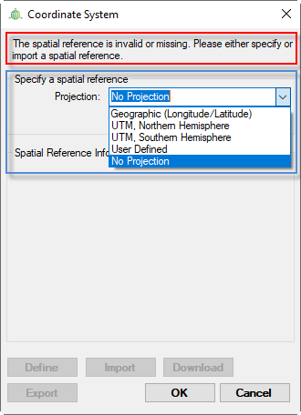
- Geographic (Longitude/Latitude): Selecting this applies the World Geodetic System (WGS) 1984 to the project.
- UTM, Northern Hemisphere: The Universal Transverse Mercator (UTM) – Northern Hemisphere projection. A drop-down menu will be enabled upon selecting this for the specification of the UTM Zone (from 1 to 60).
- UTM, Southern Hemisphere: The UTM – Southern Hemisphere projection. Similar to the UTM, Northern Hemisphere, users need to select a UTM Zone for this
- User Defined: Besides the predefined WGS 1984 geographic coordinate system and UTM projection, it is possible to define a UTM projection or import/download any projection for the current layer. Choosing this option enables the Define, Import, and Download
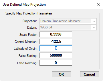
- Define button: Defines projection by configuring the map projection parameters (Figure 2). The parameters are characterized based on the UTM and WGS 84 systems. The scale factor of 0.9996 is applied for the zone width of 6° of longitude, and the scale factor of 0.9999 is applied for the zone width of 3°. The central meridian indicates the central meridian longitude of the zone. The latitude of the original is usually taken as zero, and the false easting is usually taken as 500 000 meters. False northing is taken at the zero value for the Northern Hemisphere and is taken at the value of 10 000 000 meters for the Southern Hemisphere.
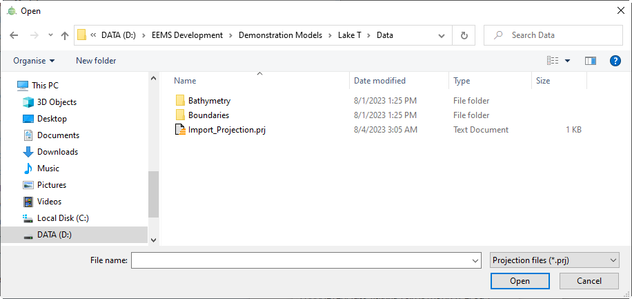
- Import button: Defines projection by importing CRS information from a *.prj file (Figure 3).
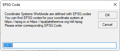
- Download button: Defines projection by downloading CRS information from the Internet with an EPSG Code (Figure 4). EPSG codes for different CSs can be found at https://epsg.io or https://spatialreference.org. The EPSG codes for the projection information for UTM zones have the form EPSG:326xx. For example, the EPSG code for UTM Zone 10 is EPSG:32610, so users can enter the value of 32610 into the search box to download its projection information.
- No Projection: Selecting this means no projection will be applied to the entire project.
With all CS options, the Export button is always enabled, allowing users to retrieve projection details and save them in a *.prj file.
Creating a new project
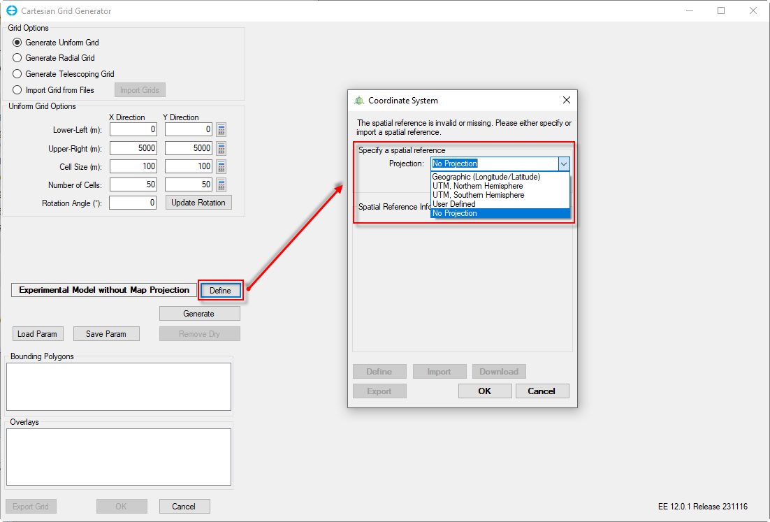
At the initial setup of a new project, users are required to create a model grid. Grid generation can be implemented by providing dimensional information and bounding polygons/overlays or importing an existing grid file. Both methods require the specification of CRS (Figure 5). In case of importing an external file (i.e., polygon, grid), either the data must contain information about its CRS or the user will need to define a CRS. In the former case and for a shapefile, the user can check the availability of CRS information via a file containing the well-known text (WKT) specification and written with a .prj extension. In the latter circumstance, EE will display the Coordinate System identifier (Figure 1), and a correct CRS must be set out to properly display the imported item. When the grid is successfully created, the choice of CRS will be saved for the entire project in subsequent EEMS sessions.
Importing an existing project
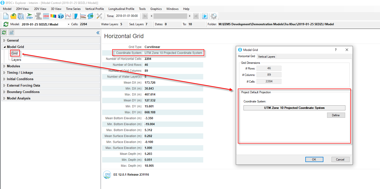
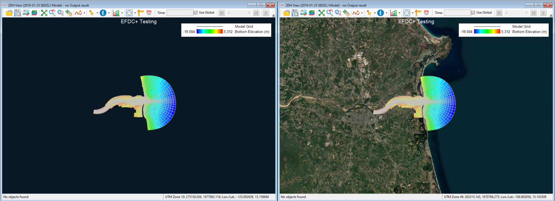
Similar to importing an external file as above, a correct CRS is required when loading an existing project. After importing the project, an inaccurate display of the location can result from insufficient CRS information. Figure 6 shows an example model of Tra Khuc Estuary overlaid on an incorrect UTM Zone (red box). To change the CRS setting, users must select Grid under Model Grid menu and click the Define button to customize the Project Default Projection. In this case, the correct CRS is UTM, Northern Hemisphere, Zone 49. Once this is applied, the model domain is placed in the right region (Figure 7).
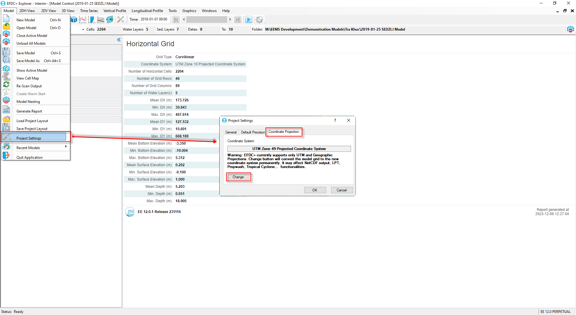
In some cases, users might prefer the computations to be conducted over a different CRS. This is possible thanks to EE’s ability to convert the current CRS of the working project to a different one. To do this, the user can go to the Project Settings option under Model menu, then select Change under the Coordinate Projection section. However, it is important to be aware that EFDC+ supports only Universal Transverse Mercator (UTM) and Geographic Projections, and any changes made will alter the projection of the model grid permanently, thus affecting multiple modeling functionalities.
